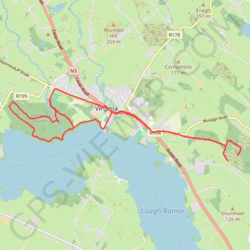
Virginia Evening Run
- Distance: 17.1 Km
- Elevation gain: 135 m
- Maximum elevation: 117 m
- Elevation loss: 135 m
- Minimum elevation: 81 m
- Moving time: 1 h 34 m
- Moving speed: 10.8 Km/h
- Maximum speed: 14.8 Km/h
- Total time: 1 h 35 m
- Global speed: 10.7 Km/h
- Date: 24/04/24
Interactive map
GPS track profile
About this GPS track
Name: Virginia Evening Run GPS track, route, trail
Coordinates: 53.82396 -7.11735 53.83909 -7.03576
Topography: County Cavan topographic map
Other GPS tracks
Click on a GPS track to view route, its statistics and profile.
RT5-1 Rosslare - Kinsale
Distance: 2,860.3 Km • Elevation gain: 27,381 m • Maximum elevation: 420 m
RT5-1 Rosslare - Kinsale
Distance: 3,867.1 Km • Elevation gain: 36,115 m • Maximum elevation: 524 m