Connemara - Day 2
#Bike
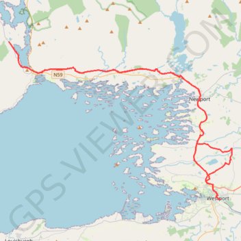
- Distance: 75.3 Km
- Elevation gain: 797 m
- Maximum elevation: 69 m
- Elevation loss: 796 m
- Minimum elevation: 0 m
Interactive map
GPS track profile
About this GPS track
Name: Connemara - Day 2 GPS track, route, trail
Coordinates: 53.79891 -9.82200 53.93364 -9.49915
Topography: County Mayo topographic map
Other GPS tracks
Click on a GPS track to view route, its statistics and profile.
Connemara - Day 1
Ireland > County Galway > Leenaun
#Bike
Distance: 62.2 Km • Elevation gain: 651 m • Maximum elevation: 76 m
Connemara - Day 3
#Bike
Distance: 62.5 Km • Elevation gain: 861 m • Maximum elevation: 291 m
RT5-1 Rosslare - Kinsale
Distance: 2,860.3 Km • Elevation gain: 27,381 m • Maximum elevation: 420 m
RT5-1 Rosslare - Kinsale
Distance: 3,867.1 Km • Elevation gain: 36,115 m • Maximum elevation: 524 m