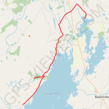
Lough Mask - Ballintober Abbey - Lough Carra
#Bike
- Distance: 51.7 Km
- Elevation gain: 387 m
- Maximum elevation: 60 m
- Elevation loss: 378 m
- Minimum elevation: 18 m
Interactive map
GPS track profile
About this GPS track
Name: Lough Mask - Ballintober Abbey - Lough Carra GPS track, route, trail
Coordinates: 53.61226 -9.41713 53.75849 -9.26206
Topography: County Mayo topographic map
Other GPS tracks
Click on a GPS track to view route, its statistics and profile.
RT5-1 Rosslare - Kinsale
Distance: 2,860.3 Km • Elevation gain: 27,381 m • Maximum elevation: 420 m
Connemara - Day 3
#Bike
Distance: 62.5 Km • Elevation gain: 861 m • Maximum elevation: 291 m
RT5-1 Rosslare - Kinsale
Distance: 3,867.1 Km • Elevation gain: 36,115 m • Maximum elevation: 524 m