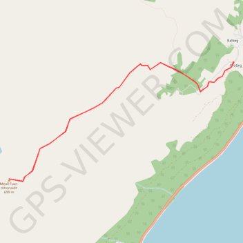
Meall Fuar-mhonaidh, near Drumnadrochit
GPX file from Walkhighlands; file is copyright Walkhighlands and must not be publicly shared on other websites. Do not remove this notice.
- Distance: 9.3 Km
- Elevation gain: 504 m
- Maximum elevation: 692 m
- Elevation loss: 504 m
- Minimum elevation: 188 m
Interactive map
GPS track profile
About this GPS track
Name: Meall Fuar-mhonaidh, near Drumnadrochit GPS track, route, trail
Start: Bunloit Road, Tornabrack, Lewiston, Highland, Écosse, IV63 6XF, Royaume-Uni (57.28016 -4.50471)
End: Bunloit Road, Tornabrack, Lewiston, Highland, Écosse, IV63 6XF, Royaume-Uni (57.28013 -4.50461)
Coordinates: 57.26421 -4.56000 57.28016 -4.50461