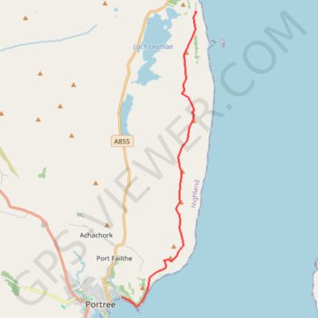
Storr to Portree coast
GPX file from Walkhighlands; file is copyright Walkhighlands and must not be publicly shared on other websites. Do not remove this notice.
- Distance: 11.2 Km
- Elevation gain: 431 m
- Maximum elevation: 383 m
- Elevation loss: 543 m
- Minimum elevation: 7 m
Interactive map
GPS track profile
About this GPS track
Name: Storr to Portree coast GPS track, route, trail
Start: A855, Highland, Écosse, IV51 9HX, Royaume-Uni (57.49392 -6.14569)
Coordinates: 57.41253 -6.18305 57.49392 -6.14520
Other GPS tracks
Click on a GPS track to view route, its statistics and profile.
Skye Trail
Royaume-Uni > Écosse > Highland > Shulista
Distance: 127.4 Km • Elevation gain: 3,959 m • Maximum elevation: 655 m