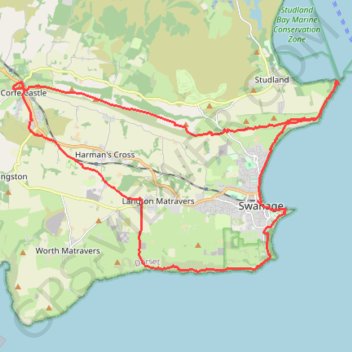
Corfe Castle - Swanage (UK)
Interactive map
GPS track profile
About this GPS track
Name: Corfe Castle - Swanage (UK) GPS track, route, trail
Start: East Street, Corfe Castle, Dorset, Angleterre, BH20 5ED, Royaume-Uni (50.64010 -2.05707)
End: Glebe Farm, Corfe Castle, Dorset, Angleterre, BH20 5NS, Royaume-Uni (50.63975 -2.06155)
Coordinates: 50.59090 -2.06160 50.64205 -1.92429
Other GPS tracks
Click on a GPS track to view route, its statistics and profile.
Tour d'Europe
France > Bretagne > Finistère > Concarneau > Landan Creis
Distance: 7,132.9 Km • Elevation gain: 44,603 m • Maximum elevation: 2,433 m