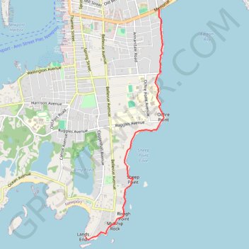
Cliff Walk at Newport, Rhode Island
Hike from Memorial Boulevard to Lands End along Atlantic Coast via Marys Seat, Easton Bay, Breakers Observation Area, Gazebo at Anglesea, Belmont Beach, Sheep Point Cove, Sheep Point, Rough Point and Midship Rock. #Hike #Walk #Nature #Coast #Sea #Atlantic #Ocean
- Distance: 5.0 Km
- Elevation gain: 46 m
- Maximum elevation: 9 m
- Elevation loss: 49 m
- Minimum elevation: -1 m
- Moving time: 1 h 27 m
- Moving speed: 3.4 Km/h
- Maximum speed: 5.1 Km/h
- Total time: 1 h 42 m
- Global speed: 2.9 Km/h
- Date: 07/04/19
Interactive map
GPS track profile
About this GPS track
Name: Cliff Walk at Newport, Rhode Island GPS track, route, trail
Start: Cliff Walk, Newport, Newport County, Rhode Island, 02840, United States (41.48520 -71.29761)
End: Cliff Walk, Newport, Newport County, Rhode Island, 02840, United States (41.45172 -71.31205)
Coordinates: 41.45124 -71.31205 41.48520 -71.29657