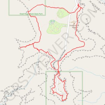
Dead Horse Point and Shafer Canyon Overlook Loop
Loop hike to Dead Horse Point via East Rim Trail and West Rim Trail in the Dead Horse Point State Park. #Hike #Loop #Canyon #Mountain #Nature #Park
- Distance: 9.2 Km
- Elevation gain: 736 m
- Maximum elevation: 1,837 m
- Elevation loss: 737 m
- Minimum elevation: 1,695 m
- Moving time: 4 h 23 m
- Moving speed: 2.1 Km/h
- Maximum speed: 5.5 Km/h
- Total time: 5 h 32 m
- Global speed: 1.7 Km/h
- Date: 20/02/24
Interactive map
GPS track profile
About this GPS track
Name: Dead Horse Point and Shafer Canyon Overlook Loop GPS track, route, trail
Coordinates: 38.46908 -109.75044 38.48803 -109.73436