Bloomsburg
Interactive map
GPS track profile
About this GPS track
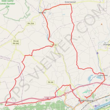
Name: Bloomsburg GPS track, route, trail
Coordinates: 40.99717 -76.59492 41.13147 -76.41997
Other GPS tracks
Click on a GPS track to view route, its statistics and profile.
Name: Bloomsburg GPS track, route, trail
Coordinates: 40.99717 -76.59492 41.13147 -76.41997
Click on a GPS track to view route, its statistics and profile.