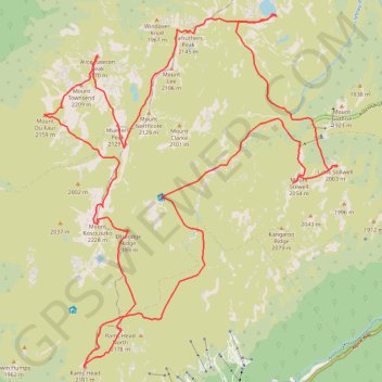
Mount Kosciuszko Loop
Kosciuszko National Park. #Hike #Loop #Kosciuszko
- Distance: 45.5 Km
- Elevation gain: 2,058 m
- Maximum elevation: 2,226 m
- Elevation loss: 2,057 m
- Minimum elevation: 1,722 m
Interactive map
GPS track profile
About this GPS track
Name: Mount Kosciuszko Loop GPS track, route, trail
Coordinates: -36.49180 148.24752 -36.40579 148.33629
Other GPS tracks
Click on a GPS track to view route, its statistics and profile.
Cloudride24.FINAL
Distance: 1,028.8 Km • Elevation gain: 21,282 m • Maximum elevation: 1,754 m