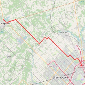
Orangeville - Brampton
- Distance: 54.8 Km
- Elevation gain: 206 m
- Maximum elevation: 461 m
- Elevation loss: 458 m
- Minimum elevation: 165 m
Interactive map
GPS track profile
About this GPS track
Name: Orangeville - Brampton GPS track, route, trail
Coordinates: 43.73512 -80.10182 43.93690 -79.62919
Other GPS tracks
Click on a GPS track to view route, its statistics and profile.
Brampton - Scarborough
Canada > Ontario > Peel Region > Brampton
Lake Ontario. #Bike #Brampton #Scarborough #Toronto #Ontario
Distance: 73.2 Km • Elevation gain: 570 m • Maximum elevation: 184 m
Bruce Trail Loop
Canada > Ontario > Peel Region > Caledon
Forks of the Credit Provincial Park. #Hike #Snowshoes #ForksOfTheCredit
Distance: 7.8 Km • Elevation gain: 172 m • Maximum elevation: 404 m